


Check out the newest GEDI article: Scalable deep fusion of spaceborne lidar and synthetic aperture radar for global forest structural complexity mapping
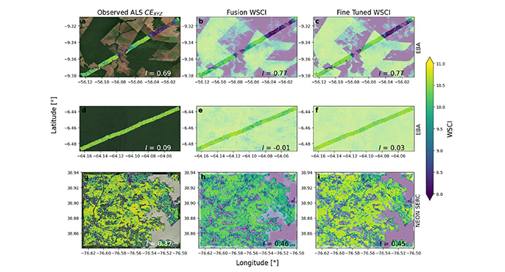
Wall-to-wall structural complexity maps at 25 m resolution for individual sites. Rows show: two EBA sites in the Brazilian Amazon (top, middle) and the NEON SERC site on 2019 (bottom). Brighter areas in the images represent areas covered by ALS. Columns display: (a), (d), (g) ALS-derived CEXYZ measurements, (b), (e), (h) predictions from the global fusion model, and (c), (f), (i) predictions after region specific fine-tuning of the model. Spatial correlations (Moran’s I) in the bottom right of each panel represent autocorrelation of CEXYZ observations on the left column (a), (d), (g), and cross-correlation between predicted and observed structural complexity in the center and right columns, demonstrating how well each model captures the spatial patterns present in the reference data.